|
|
Opendata Plugin - using data from a spreadsheet
This guide describes how to add data to OpenStreetMap which may be in the form of a spreadsheet, probably obtained by a field survey using a tool such as ODK collect or Kobo collect. Please note - if the data you are planning to add to OpenStreetMap may be termed an ‘import’ then you should consult the Import Guidelines page of the OpenStreetMap Wiki. If you are in any doubt it is best to consult first! Installing the Opendata PluginIf you haven’t already, install this plugin following the instructions in JOSM Plugins.
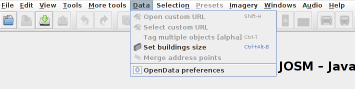
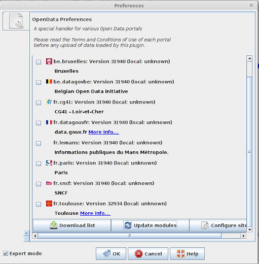
Once installed, you may click on
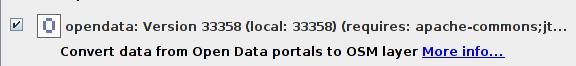
This guide is using the basic functionality, and no modules are being loaded. Preparing the spreadsheetThe wiki page at https://wiki.openstreetmap.org/wiki/JOSM/Plugins/OpenData provides more detailed information about formats which can be used. For our purposes we are assuming that the spreadsheet has been downloaded and passed to us in the proprietry .xlsx which will not load into the opendata plugin.
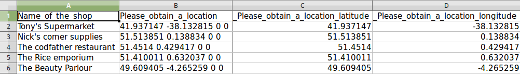
Although it is possible to load the spreadsheet into josm now, it is better to carry out further amendments to make the process easier before doing so. latitude & longitudeThe Opendata plugin is very good at extracting the latitude and longitude from spreadsheets, but if you are in any doubt it is better to change the column headings to a simpler format;
becomes;
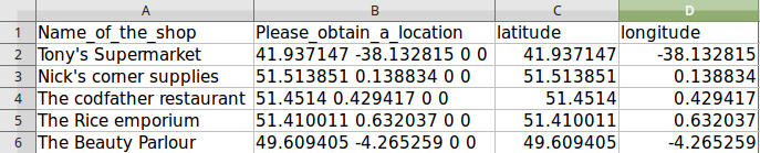
Key and ValueThe name tagOur aim now is to amend the spreadsheet so that the information is in the format expected by OpenStreetMap. The column headings will be the Key values, and the data withing the spreadsheet becomes the Value element. For our simple spreadsheet, amend the first column heading from Name_of_the_shop to name. Using the format key=value, our first spreadsheet line now becomes; If your spreadsheet has more than one name, such as a local name or official name, please consult the wiki page at https://wiki.openstreetmap.org/wiki/Names which lists many possible alternatives so that your updates to OpenStreetMap can contain all of the names that are likely to be used or searched for. Columns without a headingIf you remove the heading for a column, but keep the data below it, then the data is effectively hidden from JOSM.
Columns with data from different keys
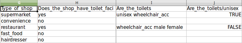
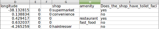
The person designing the survey, and the person carrying out the survey will often not be aware of the tags and values that have evolved in OpenStreetMap. The shop column in my spreadsheet actually contains data from two different tags, and the spreadsheet will need amending. The column heading Type of shop can be changed to shop, for the following data; but restaurant and fast_food are from the amenity key. A new column should be inserted with the heading amenity, and the data moved, so that our spreadsheet now looks like this;
sub tagsThe column heading Does_the_shop_have_toilet_faci has been abbreviated during the survey process, and originally read Does the shop have toilet facilities?. Although there is a separate tag for toilets, which is usually added to a node within a building, this actually refers to toilets which are accessible to the public. If we carried out our own survey, we know exactly what was intended with the question and answer, but if this is information passed on to us, it will probably be necessary to query what was intended. It is also extremely useful to be able to load the survey questions into a phone and carry out a ‘mock’ survey so that the layout of the questions can be seen. Careful reading of the wiki page at https://wiki.openstreetmap.org/wiki/Tag:amenity%3Dtoilets, and study of the original survey is needed before amending the spreadsheet. In particular, the wiki entry contains the information -
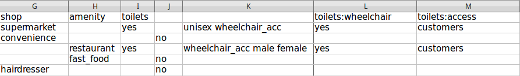
Following the advice from the wiki as best as I can, my amended spreadsheet for the information about toilets now reads;
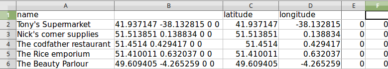
I have blanked the heading on a number of columns, so that the data will not be visible when I am carrying out my editing in JOSM. Loading the spreadsheet into JOSMClick on
A pop-up will possibly appear asking you to confirm the ‘projection method’ used when collecting the data. The Opendata plugin will attempt to calculate the ‘projection method’ used and will present this as the most likely option. Unless this has been altered in the settings by the surveyor, accepting the suggested projection but then checking when editing that the points created are appearing in likely locations is a sensible choice.
Congratulations! You’ve done all the hard work and you’re nearly ready to update OpenStreetMap with your nice new survey data. Using the ToDo pluginWithin JOSM select all of the items added by your spreadsheet, either by;
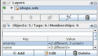
make sure you have selected all of your surveys - there are five surveys in my spreadsheet and I need to have 5 objects selected.
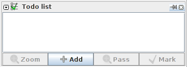
On the ToDo plugin panel, click on Add.
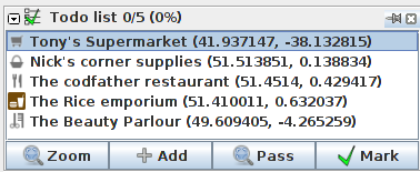
and the list of items to add should appear in the panel.
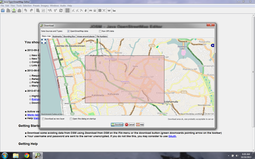
Load OpenStreetMap data as a separate layerDouble click on the top item in your ToDo list, which will centre it in your editing panel, and click on the download When the download dialog window appears, ensure you place a tick in
Compare the data between the layersEnsure you carefully check the data held in your spreadsheet against the existing data already in OpenStreetMap. There are ways of copying tags, or parts of tags (Look through the Tools and More Tools menu’s of JOSM, or read the earlier chapters within LearnOSM) between the layers. In many cases you will be merging new data with existing data. Carefully check the data, if necessary checking the history and source for the different features - it’s always possible the data within OpenStreetMap is more recent or more accurate than your spreadsheet data. When you have updated the information from one line of the spreadsheet, use the Mark button of the ToDo plugin to move onto the next item - you may have to download more OSM data if the next item is outside the area already downloaded.
Was this chapter helpful?
Let us know and help us improve the guides!
|
 , navigate to where your spreadsheet is saved, and open it within JOSM.
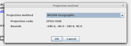
 icon.
icon. (bottom left on the next screenshot) so that your OSM data does not download into your spreadsheet data.